

Drone Services
Overview
High precision drone surveying and mapping services for construction, excavation, and infrastructure projects across the Vancouver and Sea to Sky region.
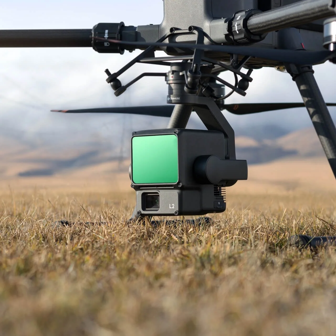
Using advanced RTK and LiDAR equipped drones, we deliver accurate, fast, and cost effective site data helping you make better decisions, reduce rework, and keep your project moving.
Technology & Equipment
We use industry leading equipment to ensure consistent, survey grade results:
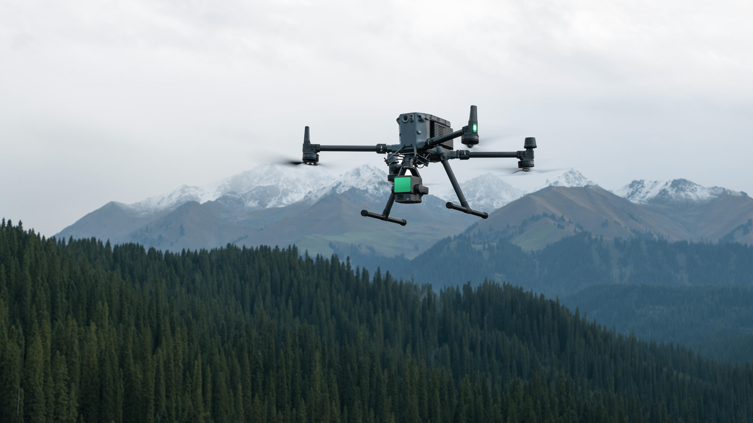
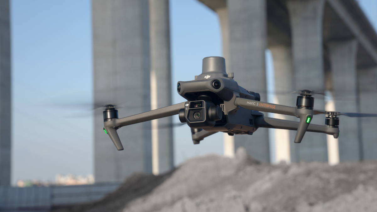
RTK enabled drones for centimetre level accuracy
LiDAR scanning systems for detailed terrain capture
GNSS base and rover systems for precise ground control
Advanced processing software for accurate deliverables
This combination allows us to deliver reliable data quickly, even in challenging terrain and remote environments.
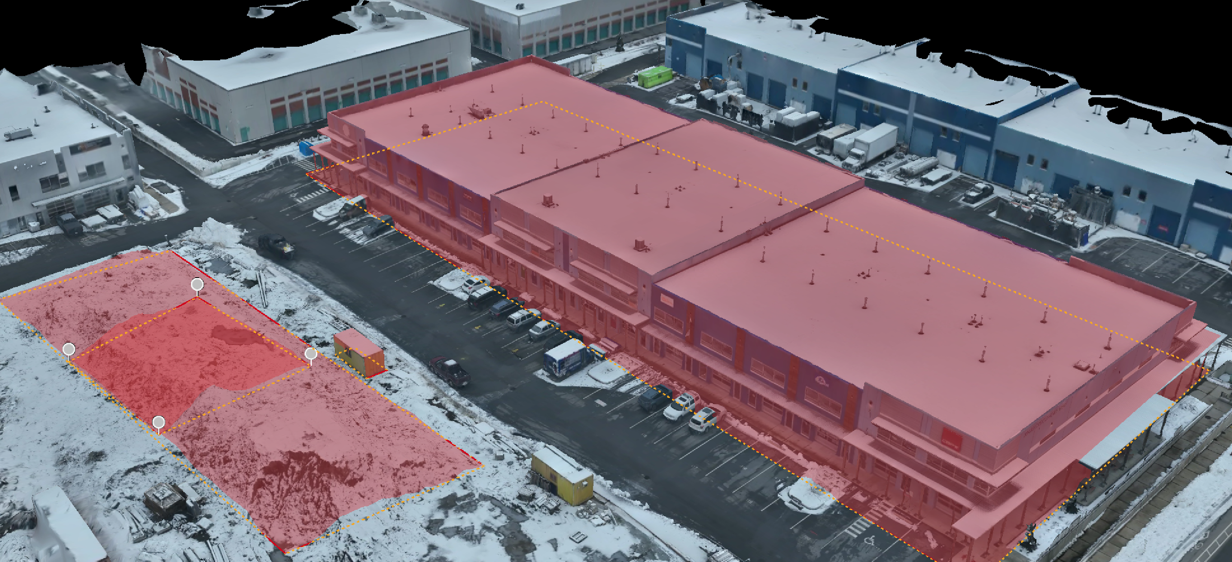
Topographic Surveys
Accurate surface models and terrain mapping for planning, design, and site analysis.
Digital Terrain Models (DTM)
Contours and elevation data
Cut & fill analysis
Pre construction site mapping
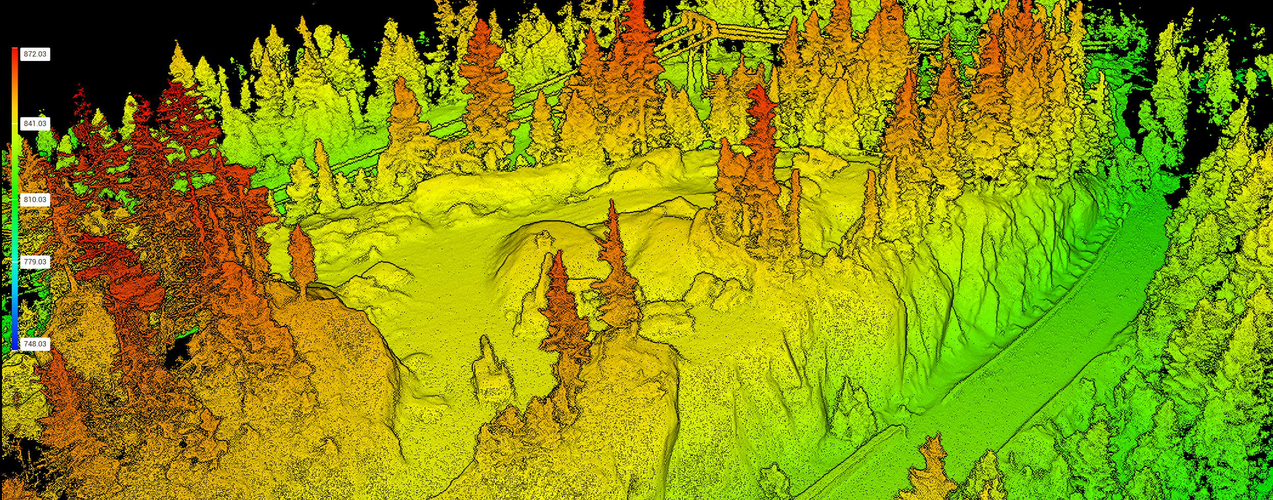
LiDAR Scanning
Advanced LiDAR data capture for complex or vegetated environments.
Penetration through light vegetation
High density point clouds
Accurate ground models in difficult terrain
Ideal for large or complex sites
Construction Progress Monitoring
Stay on top of your project with regular aerial updates.
Scheduled site flights
Visual progress reports
Comparison datasets over time
Improved communication with stakeholders
Deliverables
We provide data in formats that integrate directly into your workflow:
Orthomosaic maps (GeoTIFF)
Point clouds (.LAS .PLY .PNTS .LAZ)
Surface models (DSM/DTM)
Contours and CAD-ready files (.DXF .TIN)
Volume reports
PDF summaries for easy review
Custom deliverables available depending on your project requirements.
Why Use Drone Surveying?
Faster turnaround than traditional survey methods
Reduced site disruption no need to stop work
Improved safety no need to access hazardous areas
Cost-effective for large or repeat surveys
High accuracy with RTK and GNSS integration
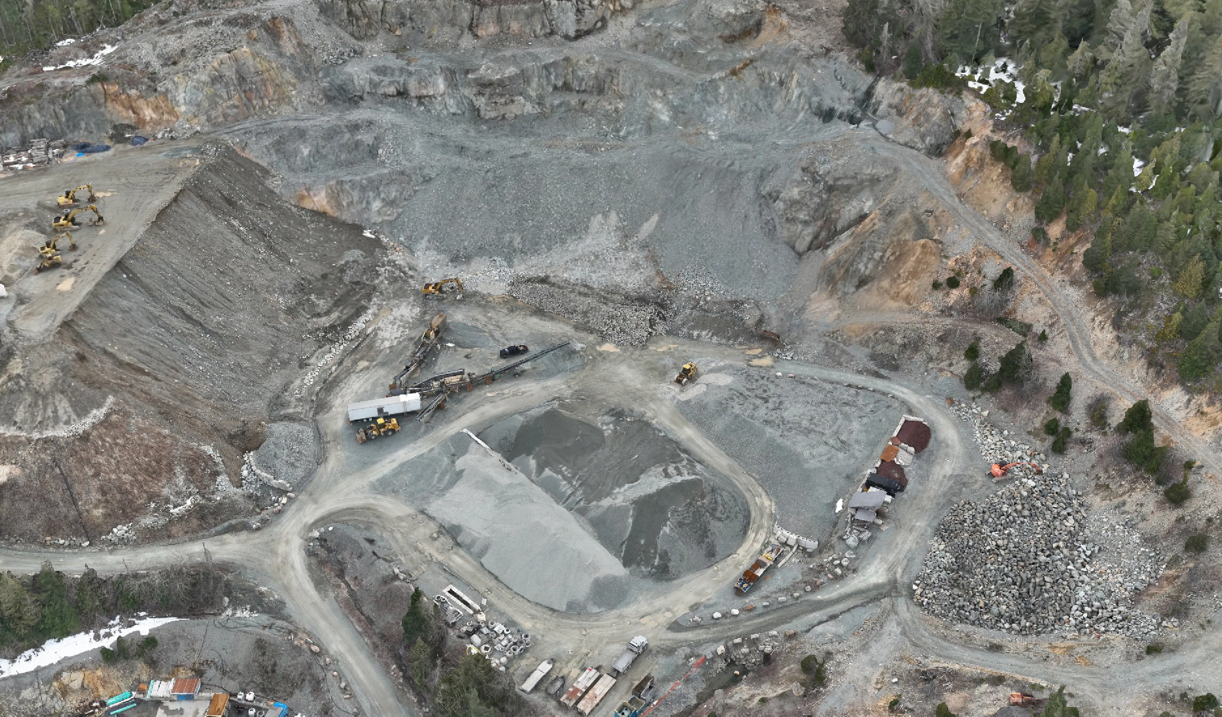
Stockpile Volume Calculations
Fast and repeatable volume measurements without disrupting operations.
Aggregate, soil, and material stockpiles
Quarry and pit monitoring
High accuracy volume reports
Repeat surveys for tracking changes over time
Photogrammetry Mapping
High-resolution aerial imagery processed into detailed 2D and 3D outputs.
Orthomosaic maps
3D models
Site overviews for planning and reporting
Progress tracking
Inspection Services
Safe and efficient inspection of hard to reach areas.
Roof and structure inspections
Earthworks and slope monitoring
General site condition assessments
Service Area
Based in the Sea-to-Sky corridor, we provide drone survey services in:
Squamish
Whistler
Pemberton
Vancouver and surrounding areas
Why Choose Jordan’s Rentals Ltd.
Real construction experience not just a drone operator
Local knowledge of Sea to Sky terrain and conditions
Owner-operated direct communication and accountability
Modern equipment delivering reliable, consistent results
Flexible service tailored to your project
Insurance & Compliance
Jordan’s Rentals Ltd. carries comprehensive commercial drone insurance to support safe and professional operations across all projects.
Coverage includes:
$3,000,000 liability coverage per occurrence for bodily injury and property damage
Professional indemnity coverage for survey and mapping services
Coverage for a range of commercial UAV platforms and operations
Worldwide operational coverage (subject to standard exclusions)
Compliance with international aviation liability standards
All work is carried out in accordance with Transport Canada regulations, ensuring safe, compliant, and reliable data capture on every project.